

Arches National Park & Canyon lands National Park Utah
This is a post to summarize my amazing whirlwind trip to Arches National Park and Canyonlands National Park. My family and I took an extended weekend from Thursday to Monday in late September to visit these two parks in Utah. Great experience overall and a trip to finally check off my bucket list. I highly recommend doing both these parks and in one timeframe if you are planning on being in the area. From Arches, Canyonlands is a quick hour drive and well worth the different experiences that Canyonlands provides. Canyonlands took us 2 days to explore well and Canyonlands left many parts unexplored but were able to experience a lot in a single day.
Thursday started out with an early flight out from San Diego to Salt Lake City where we rented a car and started the 3-hour drive out from the city through the mountains and finally into the high desert. Arches sits at just over 4000 feet of elevation. The 3-hour drive goes by quickly and for us, it provided great views of snowcapped mountains and even some fall colors that I seldom get to see living in San Diego.
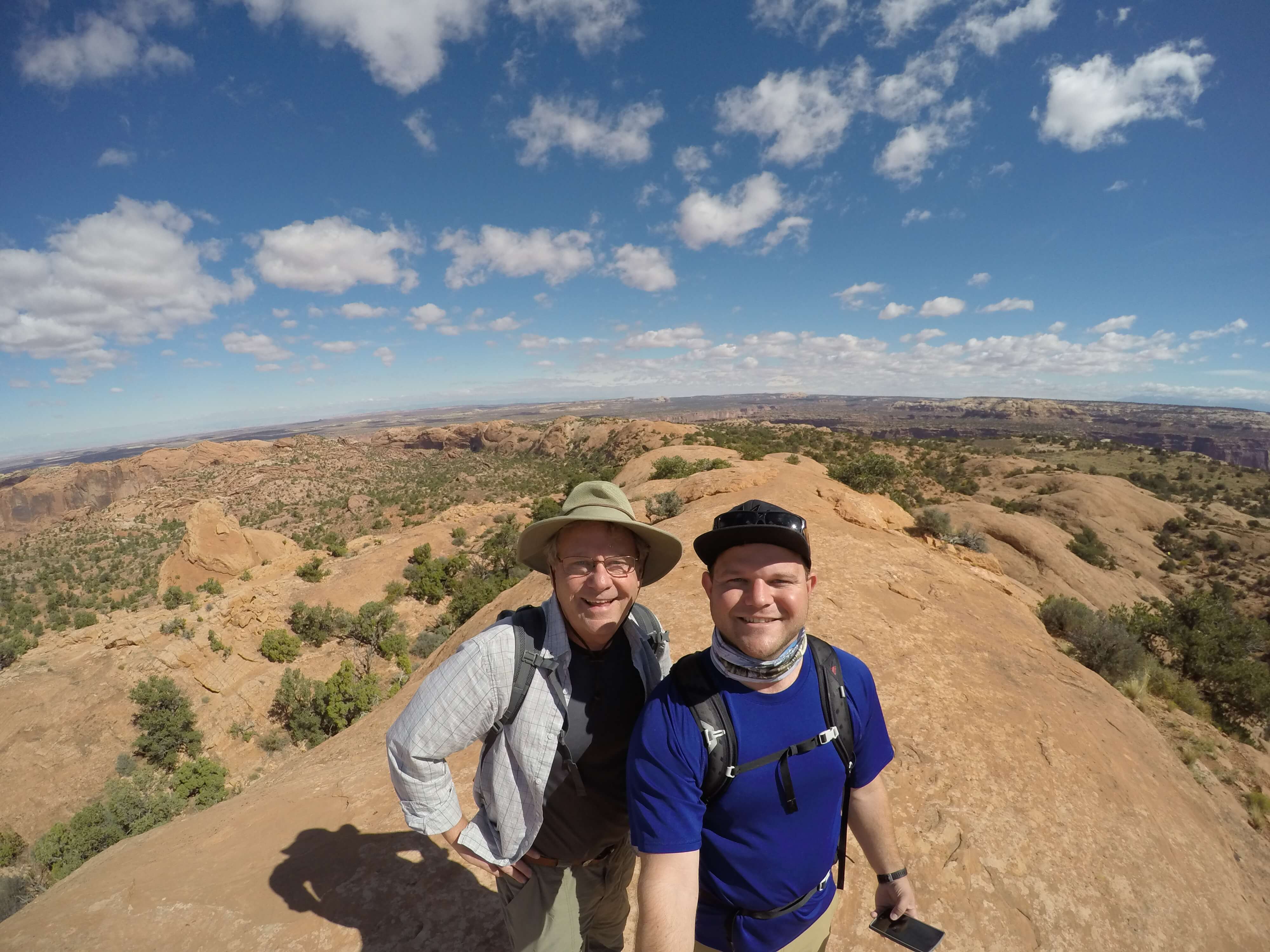
Upon arrival at Arches National Park, in late the afternoon, we entered the park and saw a very busy visitor center. A quick stop at the visitor center to get some information from the rangers and we were off into the park. During our quick stop at the visitor center, we also signed up for a ranger-led hike through the Fiery Furnace. Sign-ups are done days in advance and sell out quickly. I will talk more about the hike later. The entrance really is just a bit underwhelming since there are no arches actually in view. Incredibly tall walls of rock do line the roadway and are amazing but where are the arches? From the entrance, you drive up a windy road another 500 feet or so in elevation and are greeted by a valley with towers and one side and openness on the other. There are specific towers located in this area called the Courthouse Towers. Definitely worth a stop to see from the many lookout parking areas along the road. We did not see any actual arches yet but we were determined to see some that evening.
Since we showed up late afternoon Thursday we did not have much time before nightfall and were not prepared for any night hike. Having sat in a plane and car all day though we needed to get out and hike something. We chose the ~1-mile round trip hike to Upper Delicate Arch Viewpoint. From early on in the trail, you can get a glimpse of Delicate Arch in the distance. Even after getting to the end of the trail, the Delicate Arch is still quite far away. It can definitely be seen but for any good pictures, zoom is needed. The short hike was nice but it left us wanting to see more arches, especially the iconic Delicate Arch up close.
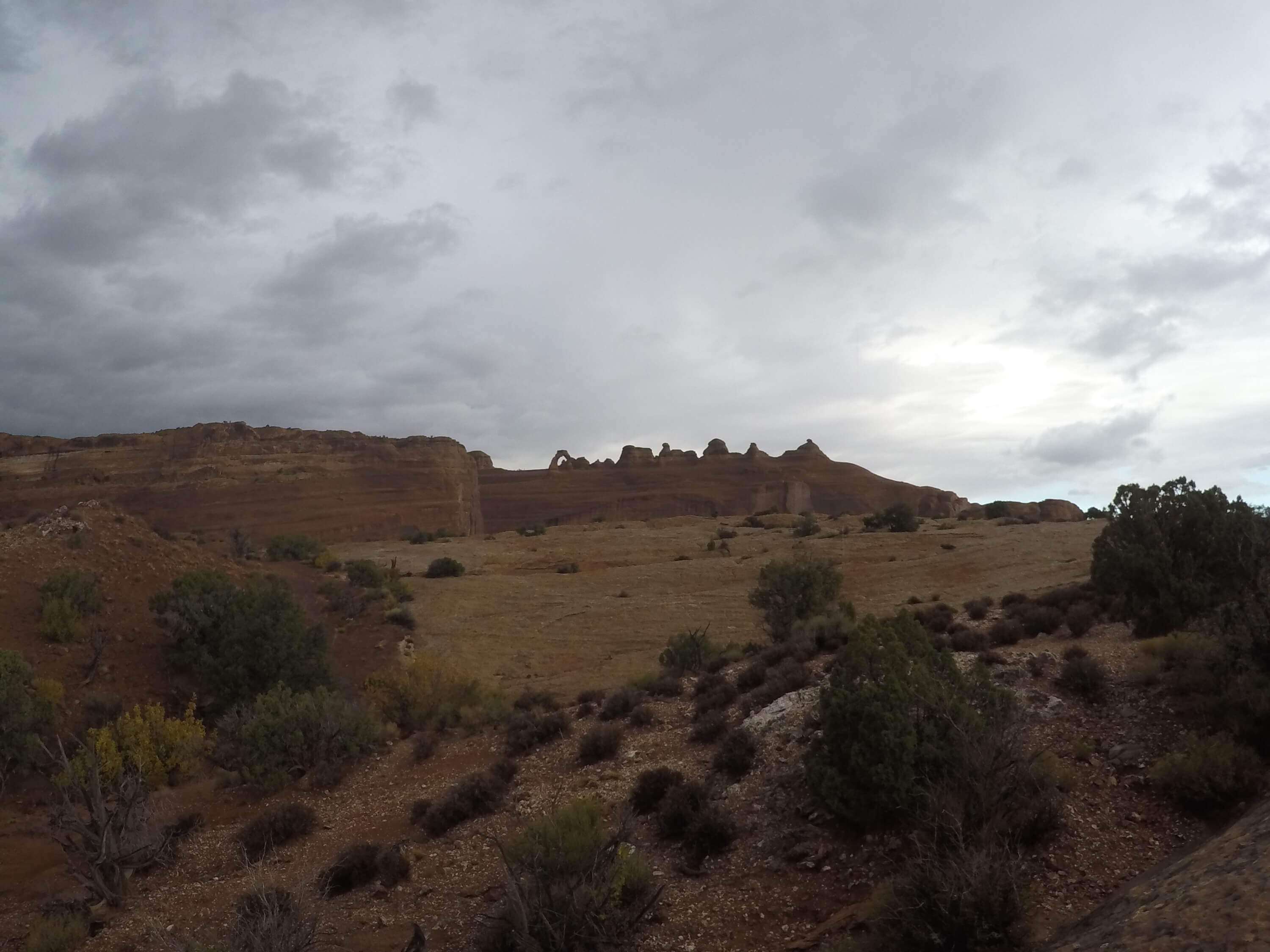 View from Upper Delicate Arch Viewpoint trail, no zoom, Arches National Park
After the quick hike, we headed back to the hotel in Moab. I would recommend staying in the “downtown” portion of Moab somewhere between W 400 N Street and E 300 S Street just for the fact that you can easily walk to the touristy shops in the city and the local eateries. We stayed a little further out from town which was not a problem but the convenience of being able to simply walk out of your hotel into town would be worth it.
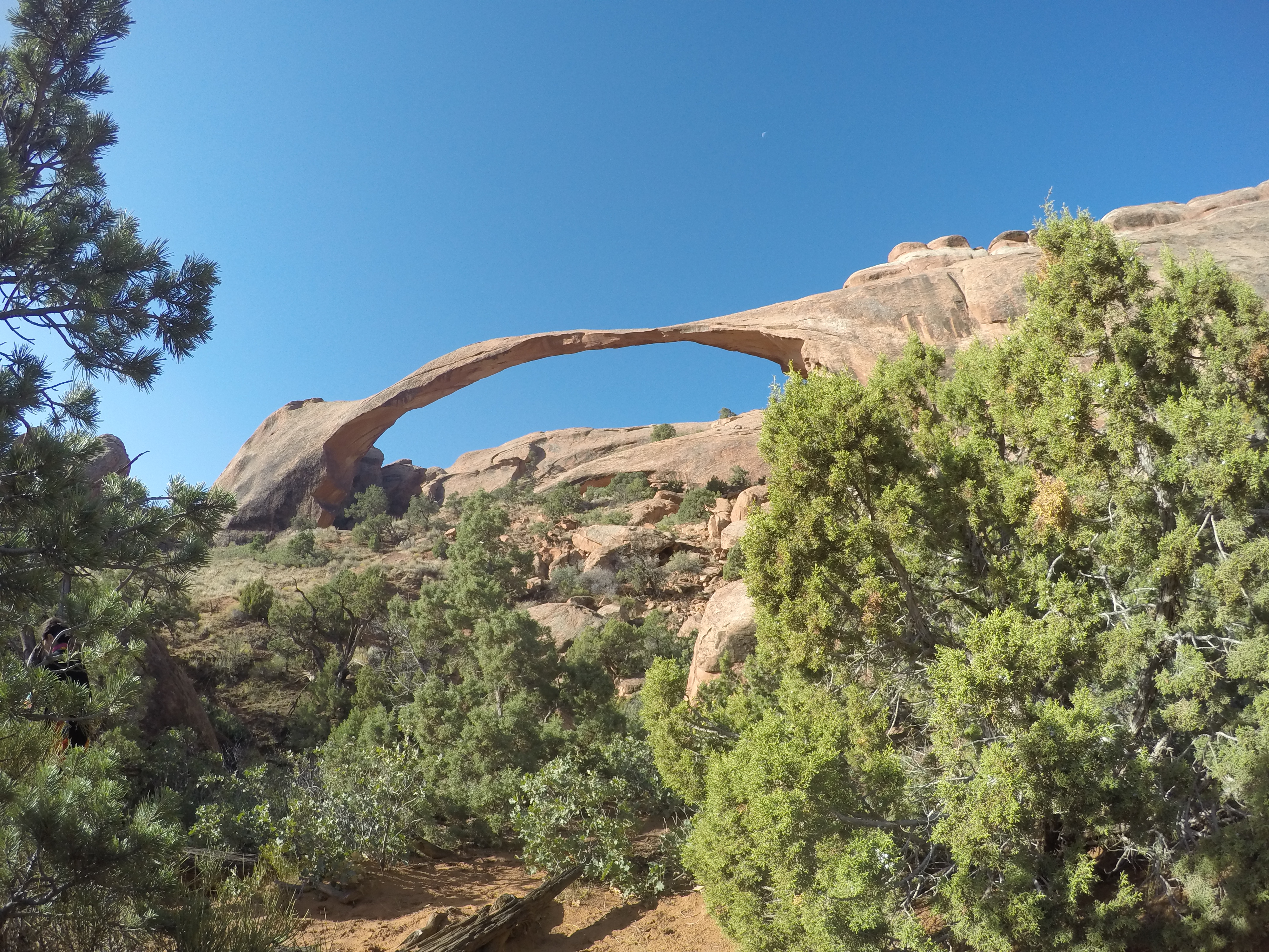
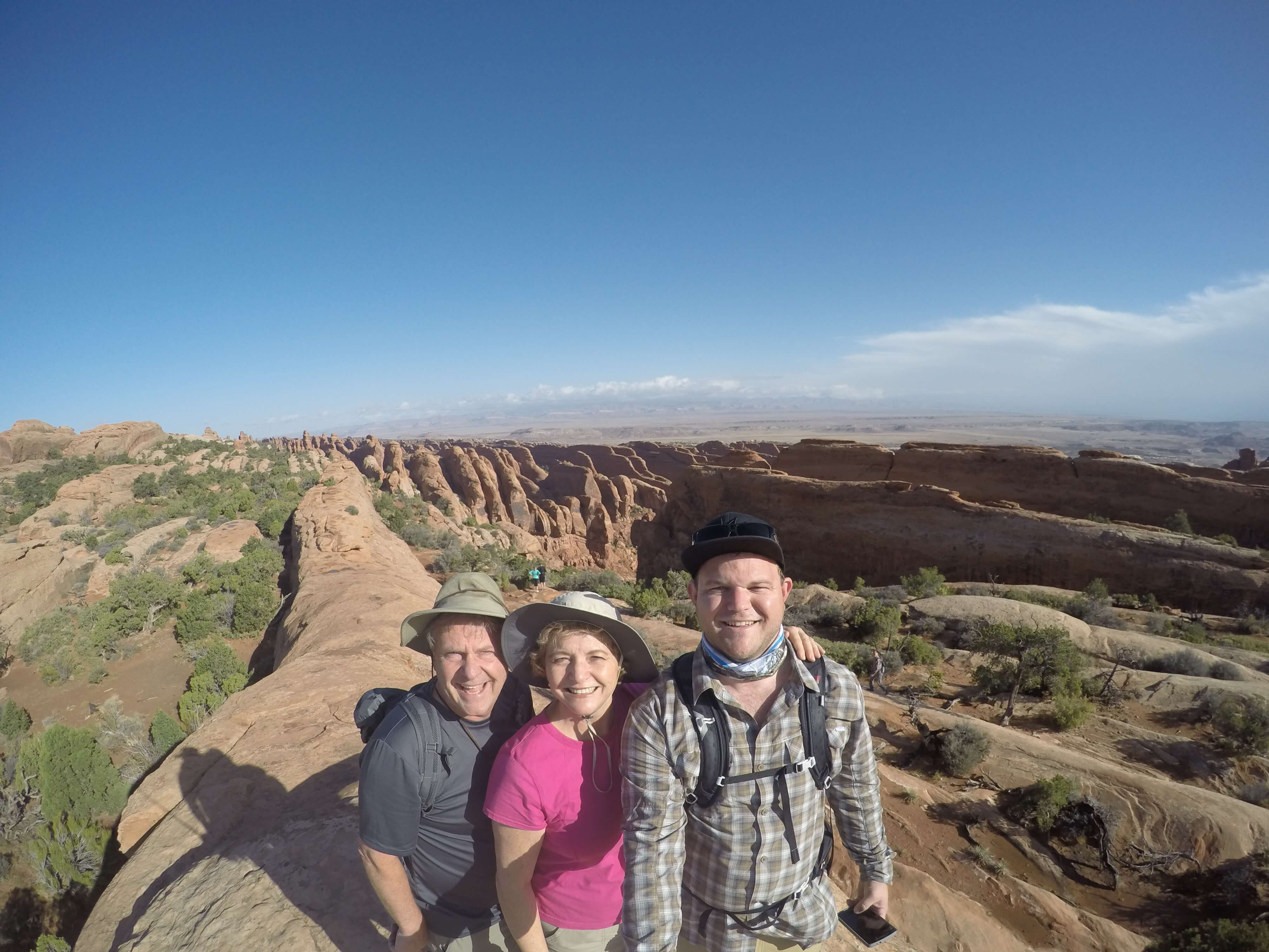
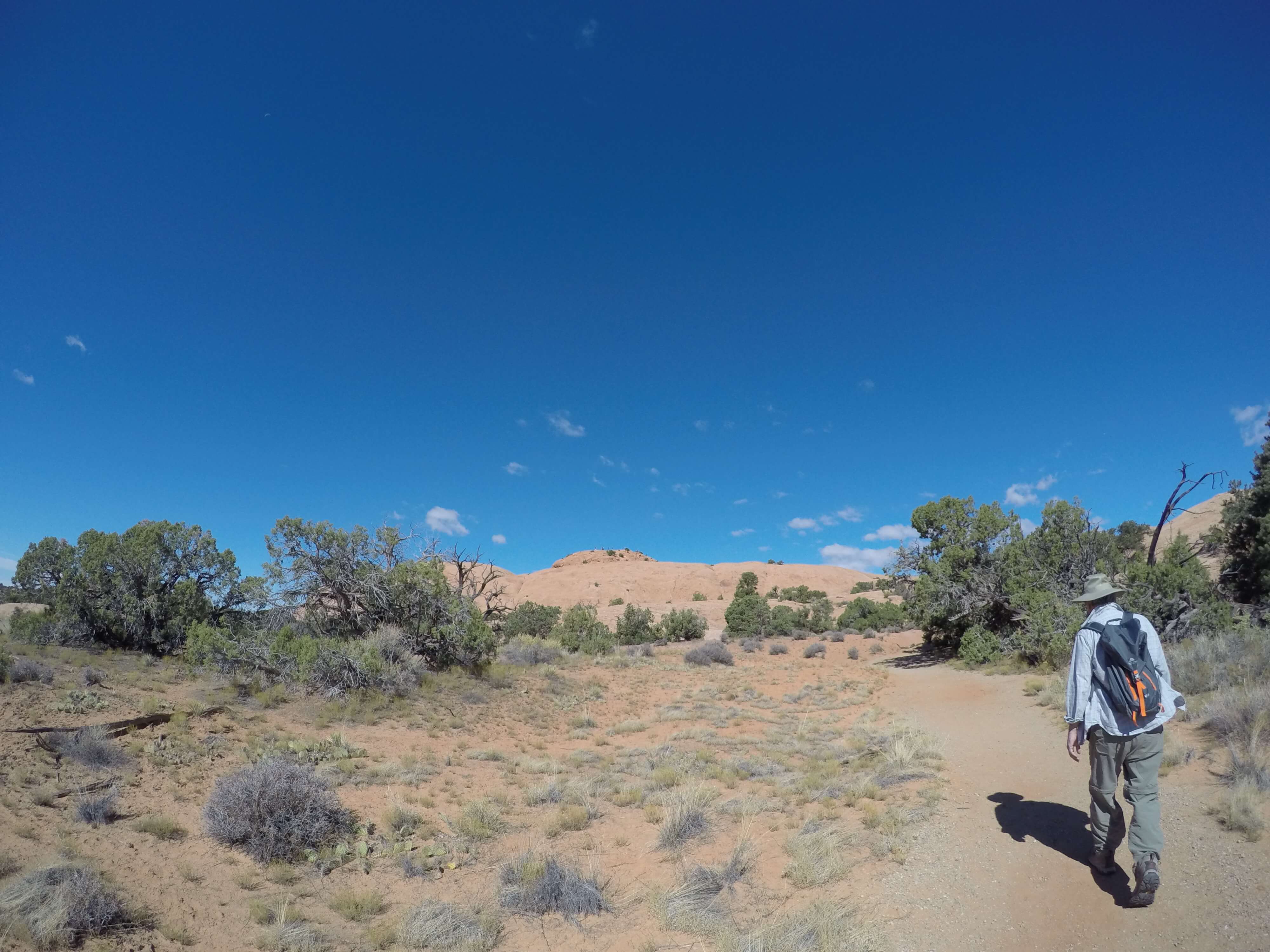
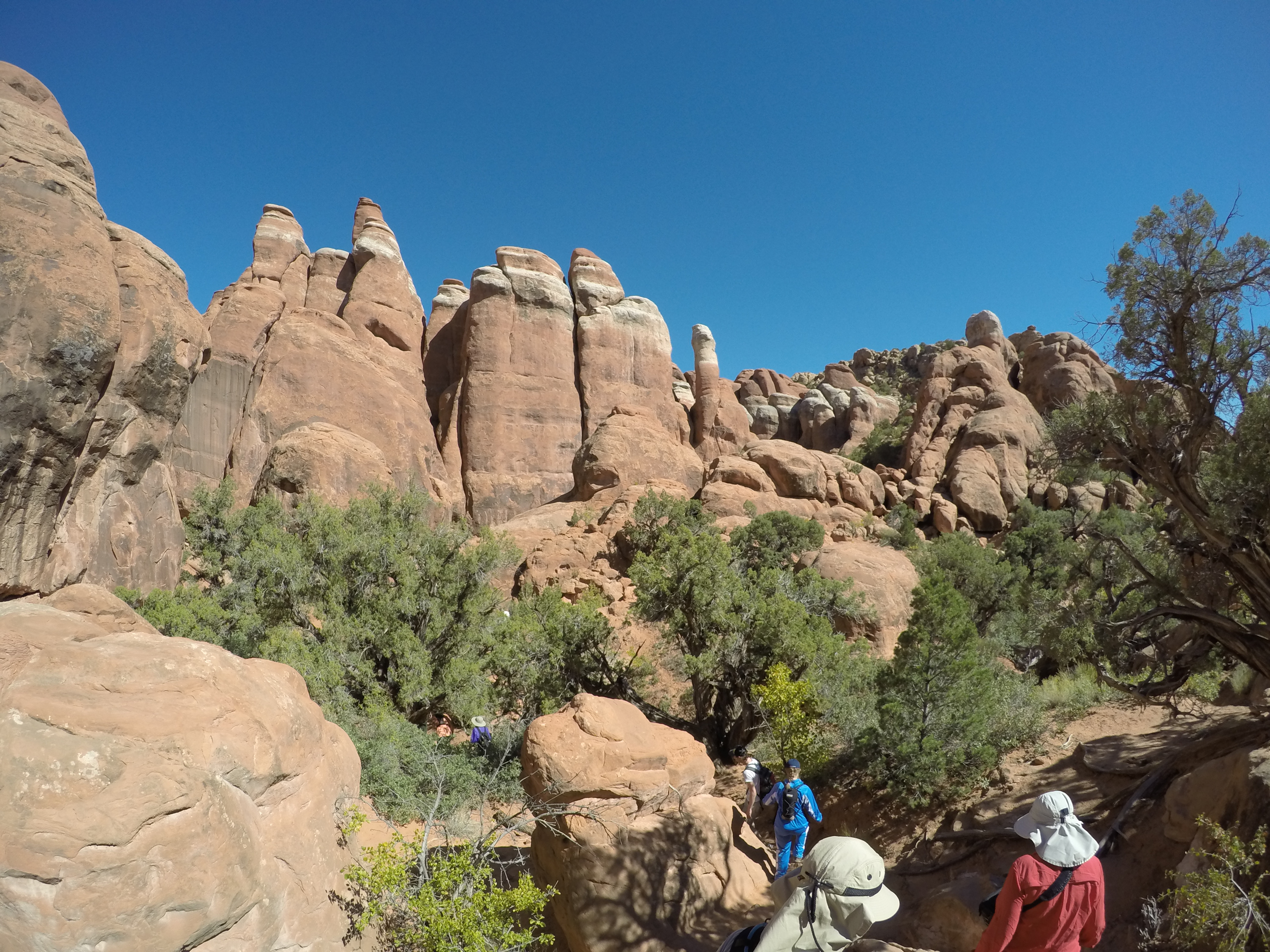
Friday we got an early start and did a hike that was high up on my list, Double O Arch trail. The nice part about this hike is that it lets you see many arches including, Tunnel Arch, Pine Tree Arch, Landscape Arch, Partition Arch, Navajo Arch in addition to Double O Arch**.** Every arch other than Landscape Arch and Double O Arch requires a small hike off the main trail nothing further than half a mile and all the arches are well worth the side trip.
On the start of the hike we took the short trails to visit Tunnel Arch and Pine Tree Arch. Both close to each other and both barely off the main trail.
About a mile into the hike, you hit the "primitive" portion of the trail. This trail starts just after Landscape Arch. From all the arches I saw during my trip this must have been the longest arch. It's unreal how the arch is still standing. Infographics along the trail say pieces of the arch fell off in 1991 but the overall arch is still intact. The Landscape Arch was beautiful sight and I was excited to get on the primitive trail and get away from the more crowded graded trail.
Many of the hikes in Arches have primitive trails, which essentially means you are following cairns to keep you on trail. They are also more difficult trails requiring some scrambling and paying attention to where trail goes. The very start of the primitive trails is the hardest part of the Double O Arch trail so if you can get past it there should be no difficulty going the whole way. The primitive trail is not too difficult but does require a good sense of balance and the ability to lift your legs high and pull your body up. The rocks are not slippery and foot holds are worn into steeper locations.
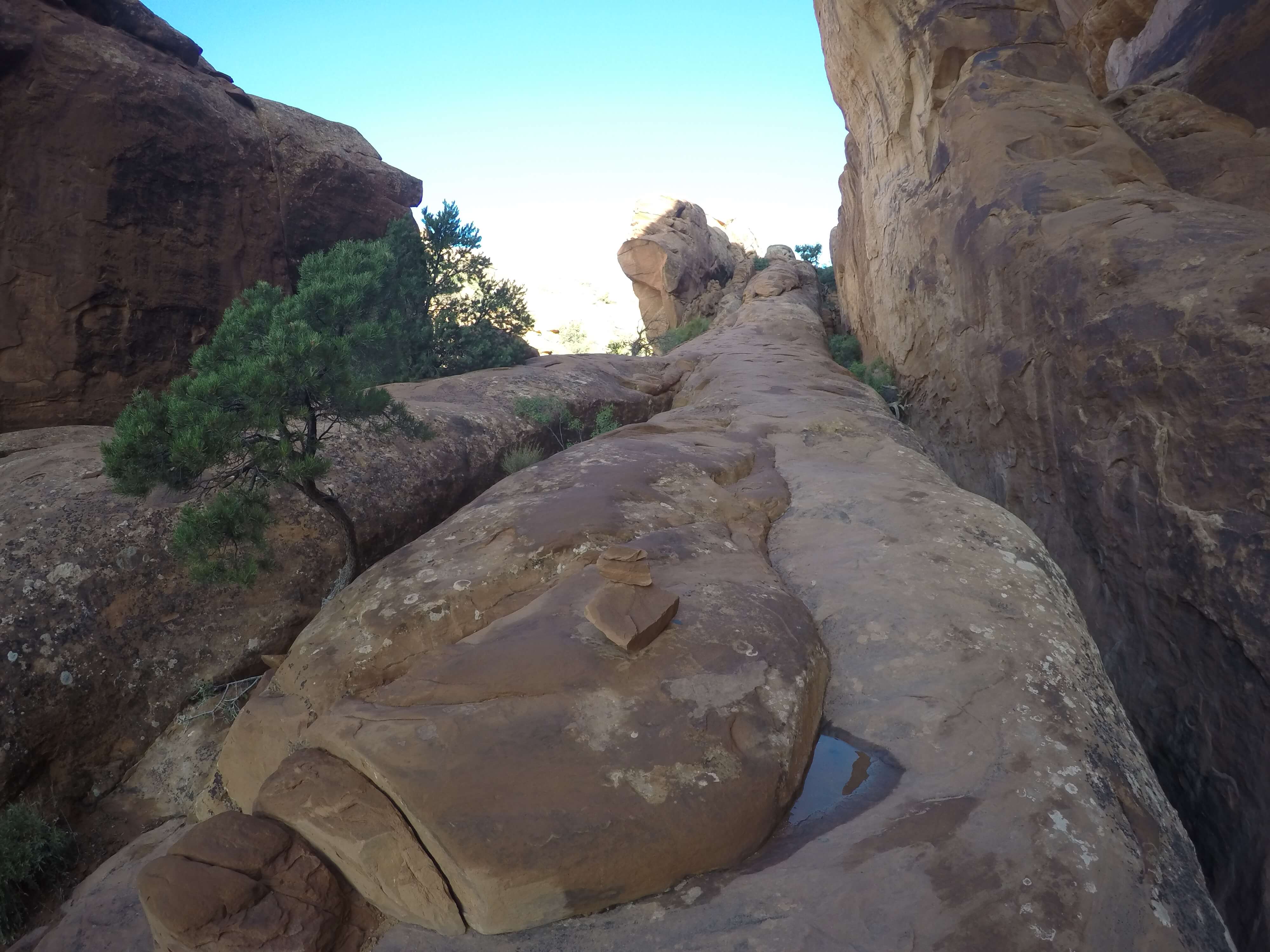 The hardest part of primitive Double O Arch trail, but really not too difficult at all, Arches National Park
I mentioned cairns above and these really are fun trail markers. Cairns are piles of rocks and mark where you want to go. The rangers at the park did not want to displace wildlife and put in many staked signs or build out standard trails throughout the park, it just is not feasible with all the rocks and elevation changes. Many staked signs would also disrupt the wildlife. It is recommended that when on the primitive trails you mark out the next cairn in front of you before moving forward. It can be easy to get off trail if you are not paying attention. Watch out for visitor made cairns but there really is no way to tell so just make sure that if you haven't spotted a cairn in 50 - 100 feet you may want to go back to where you last saw one and make sure you are moving in the right direction. There are usually other hikers you can use to help keep you on the trail and the trails are heavily worn so it is difficult to get lost. But just keep in mind you are looking for piles of rocks ahead of you not trail signs.
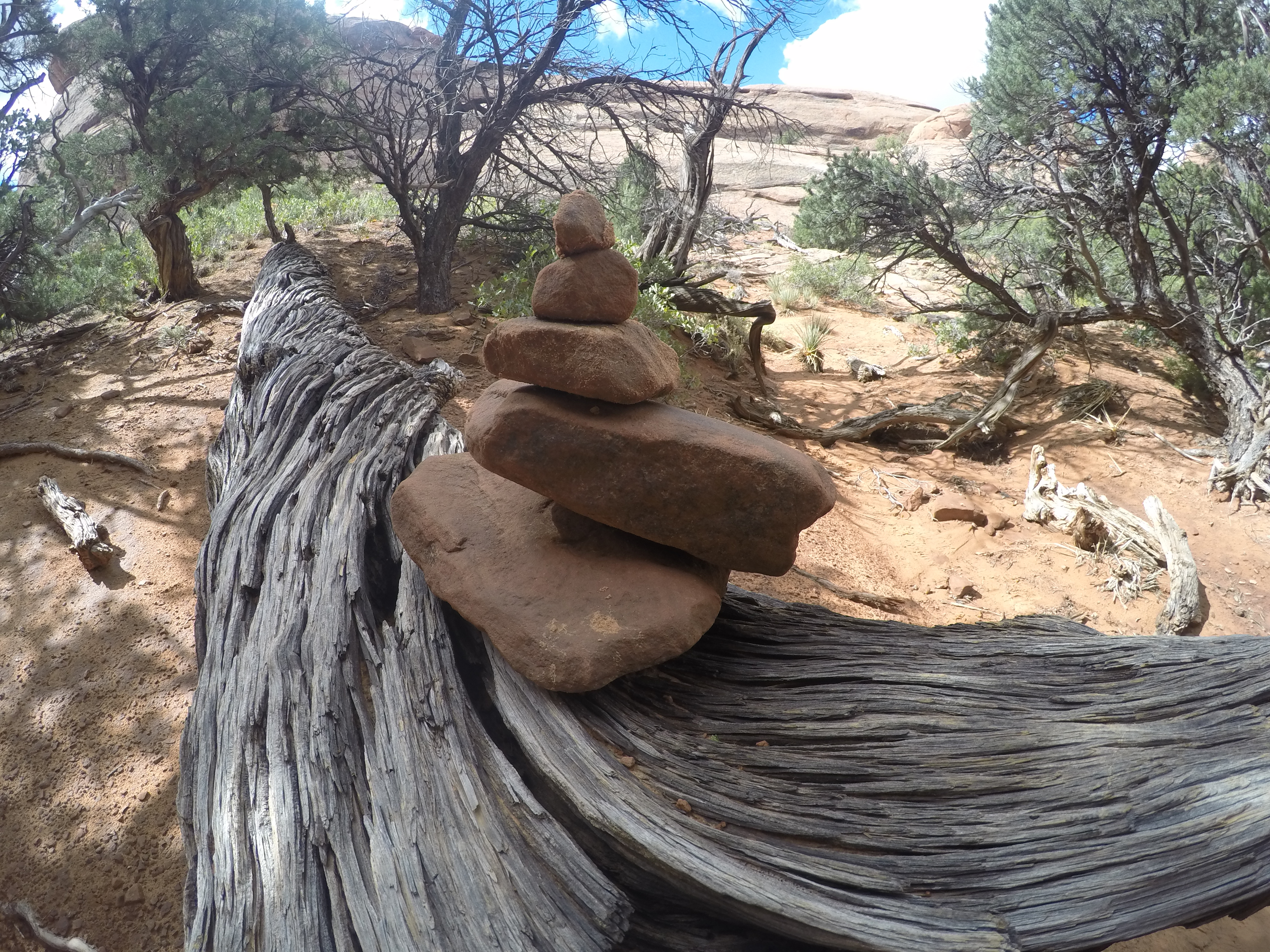 Cairn found on Navajo Trail, Arches National Park
The views on the way from Double O Arch are incredible and way worth the taking the primitive trail to get the full experience of the park. If we had stopped at Landscape Arch we would have never gotten this view. 360 views of the whole park and long-distance views going out for many miles into the surrounding desert. Couldn't have asked for a clearer day
 View along Double O Arch Trail, Arches National Park
Continuing along the trail is not too tricky but again just make sure you are keeping cairns in mind. The worn-down trail is not hard to follow but if you are not paying attention you can get a little of course. Do not blindly follow the person in front of you because you think they know what they are doing. Make sure you are following and spotting the cairns yourself.
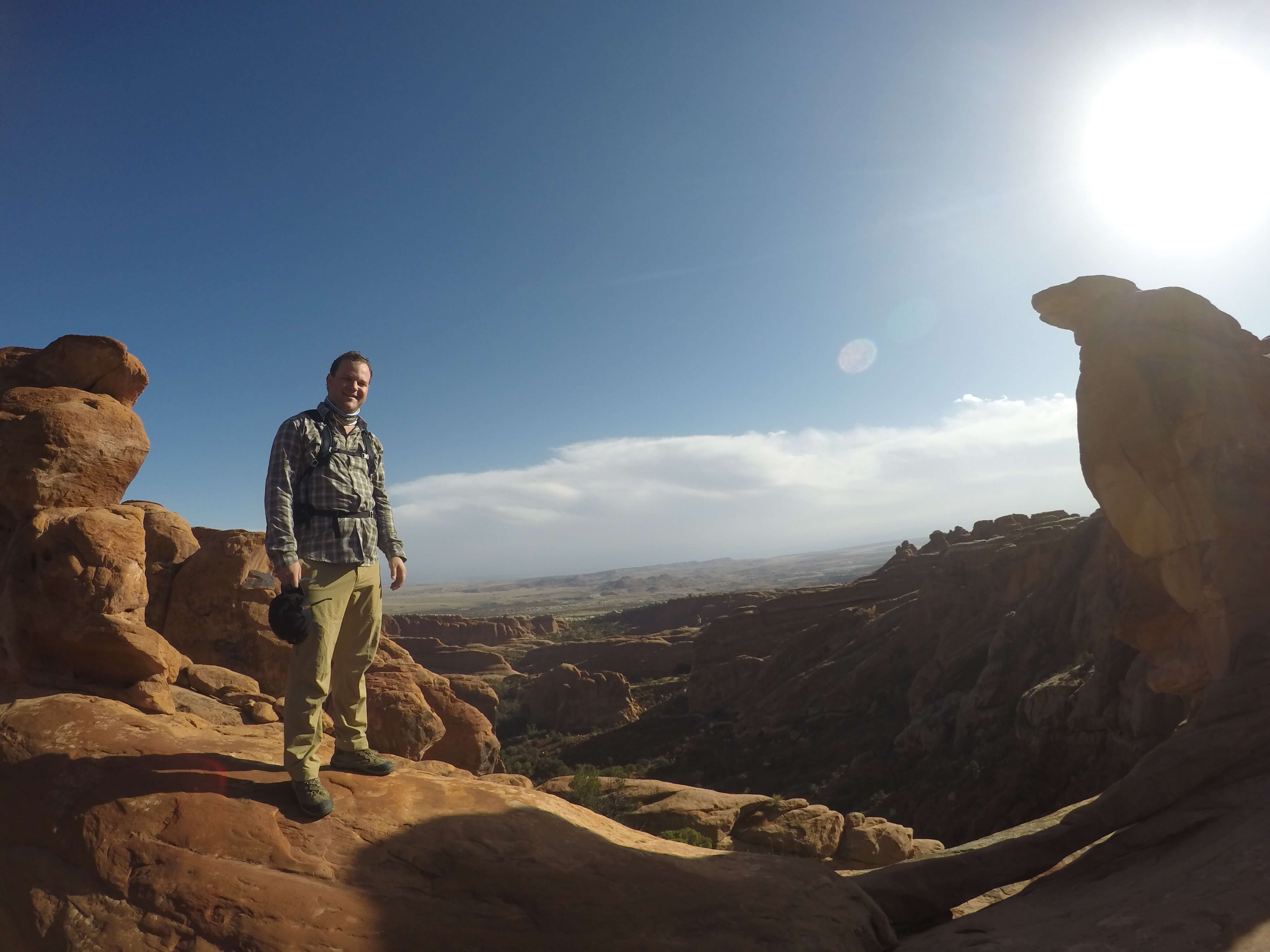 More views from along Double O Arch trail, Arches National Park
The 4.2-mile round trip hike, if no side trails are taken, brings you to the beautiful Double O Arch. It's hard to choose a favorite arch but this is definitely in my top 3. Since the trail out to this arch is marked as primitive it is not visited or as busy as some of the other arches in the park. This arch formed with one large arch and another smaller arch forming underneath it. It's amazing that these are still standing and have lasted so long. It looks like these arches should crumble and fall at any moment but they have been holding up for 10's of thousands of years. They will fall someday but by then newer ones will have also formed.
 Double O Arch, Arches National Park
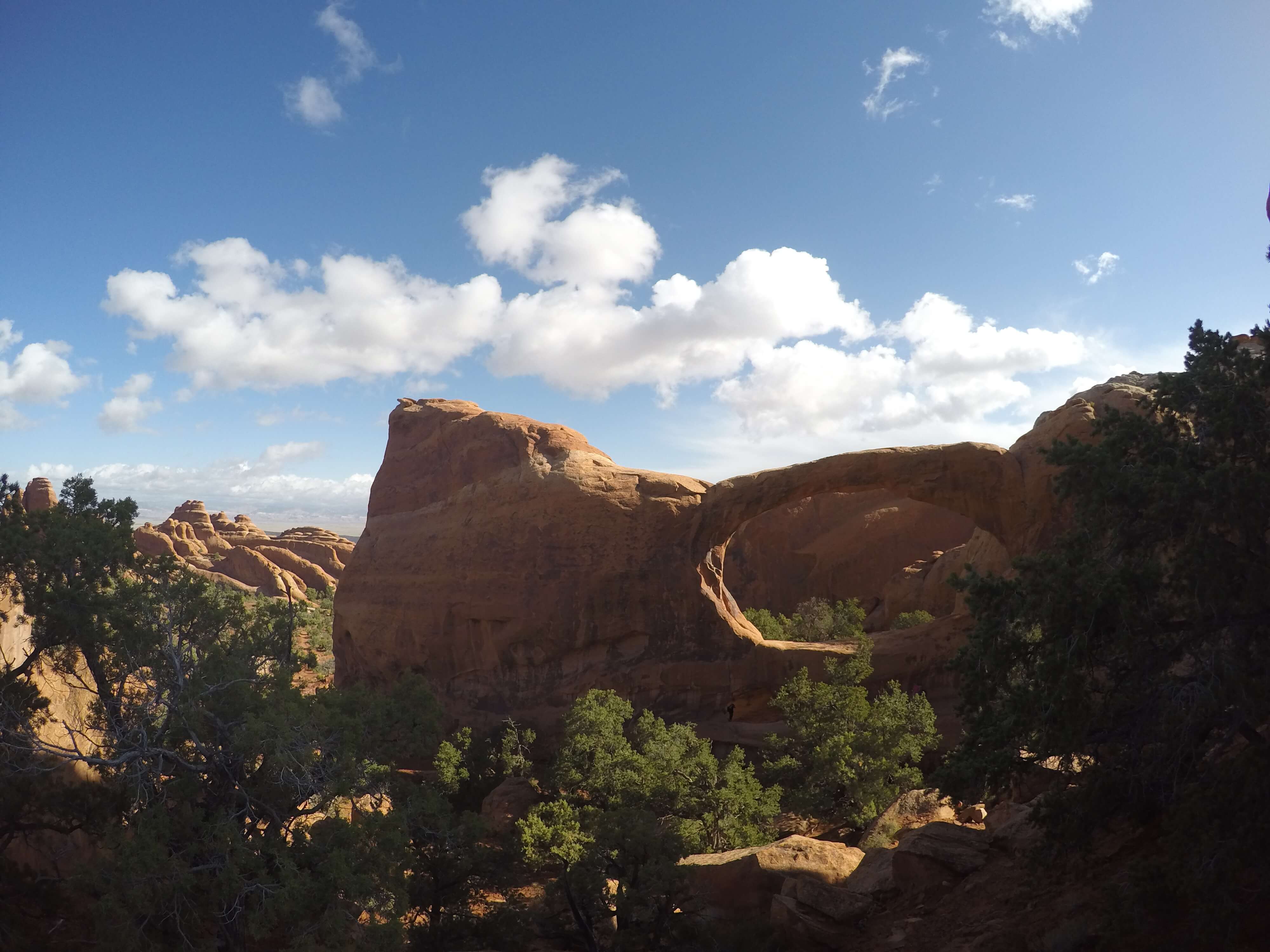
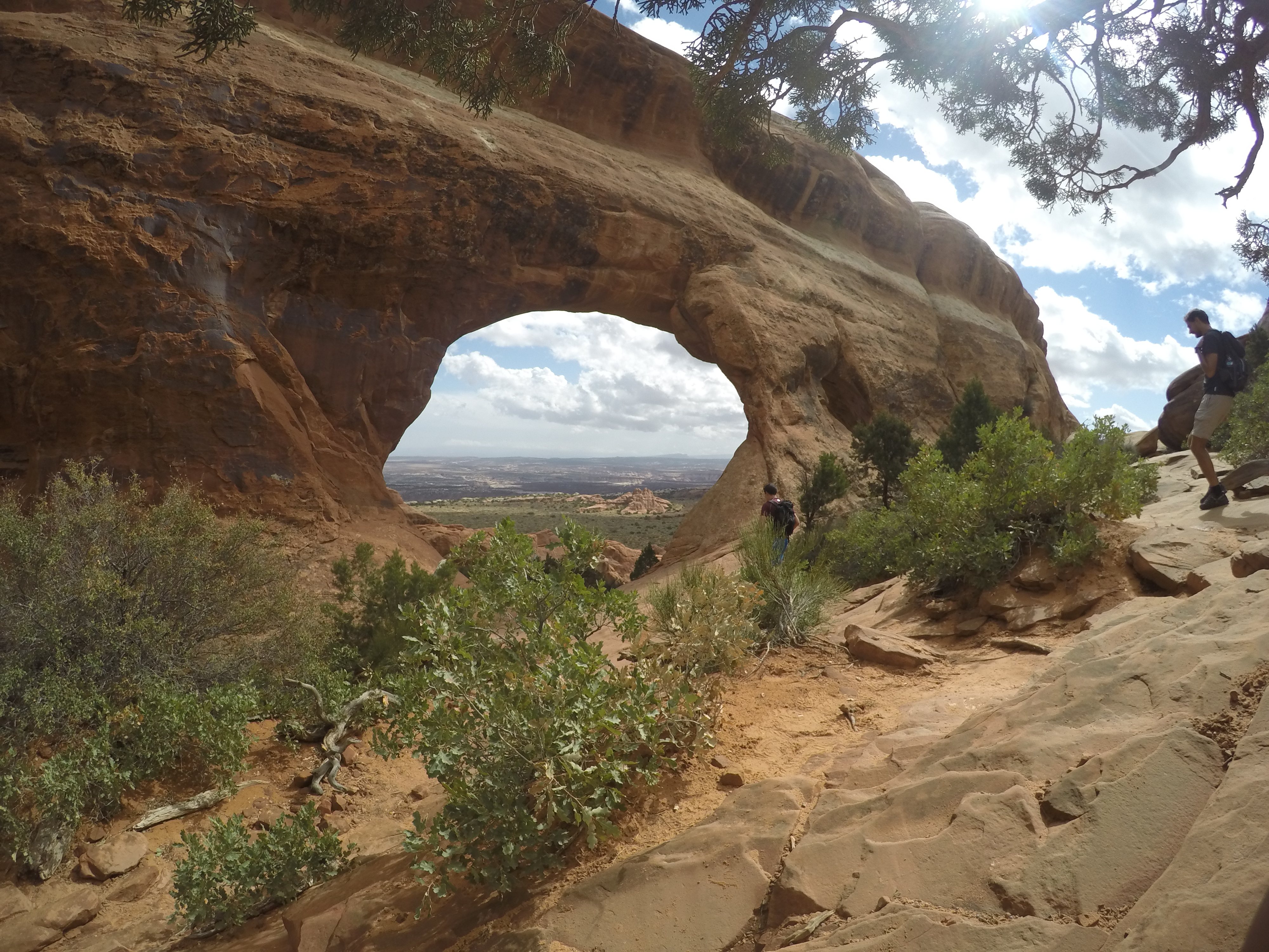
On the trail back we stopped at Navajo Arch and Partition Arch both well worth the small side hike to get to. Navajo Arch sneaks up on you. It is hard to imagine that you are hiking to an arch when you are on the trail. You are following along a wall of rock for most of the trail but all of a sudden an arch pops up and it's a nice big one. This is almost the same for Partition Arch. They both seem to be holes in a wall that really are not expected to be there. It's incredible that such a solid and thick wall could erode and break down in such a way to build these arches.
 Navajo Arch, Arches National Park
 Partition Arch with a great view through the arch, Arches National Park
The ~7-mile trip we took with all the side trails to other arches was a great day hike and really tired us out especially since we were not used to the higher elevation. Since in San Diego we are basically at 0 feet above sea level.
We decided to make it an easy afternoon where we would check out the lookout points on the way back to the entrance of the National Park as well as a stop at Double Arch, North/South Window Arches, and Turret Arch for quick easy less than half-mile hikes. All three of these arches are very close to each other and accessed from the same parking lot. If you want to see a lot of arches and have very little time, this is the place to stop. I could not have asked for better weather. We had amazing blue skies treating us to great views of the park.
Saturday, oh my gosh another beautiful day in Utah, was spent in Canyonlands National Park at the Island in the Sky region. With only a day there, we still experienced a lot. The park is made up of many shorter hikes (less than a mile) and then many long hikes requiring all day or even multiple days. We took the route of many shorter hikes to get a good broad experience of the park in the day timeframe that we had.
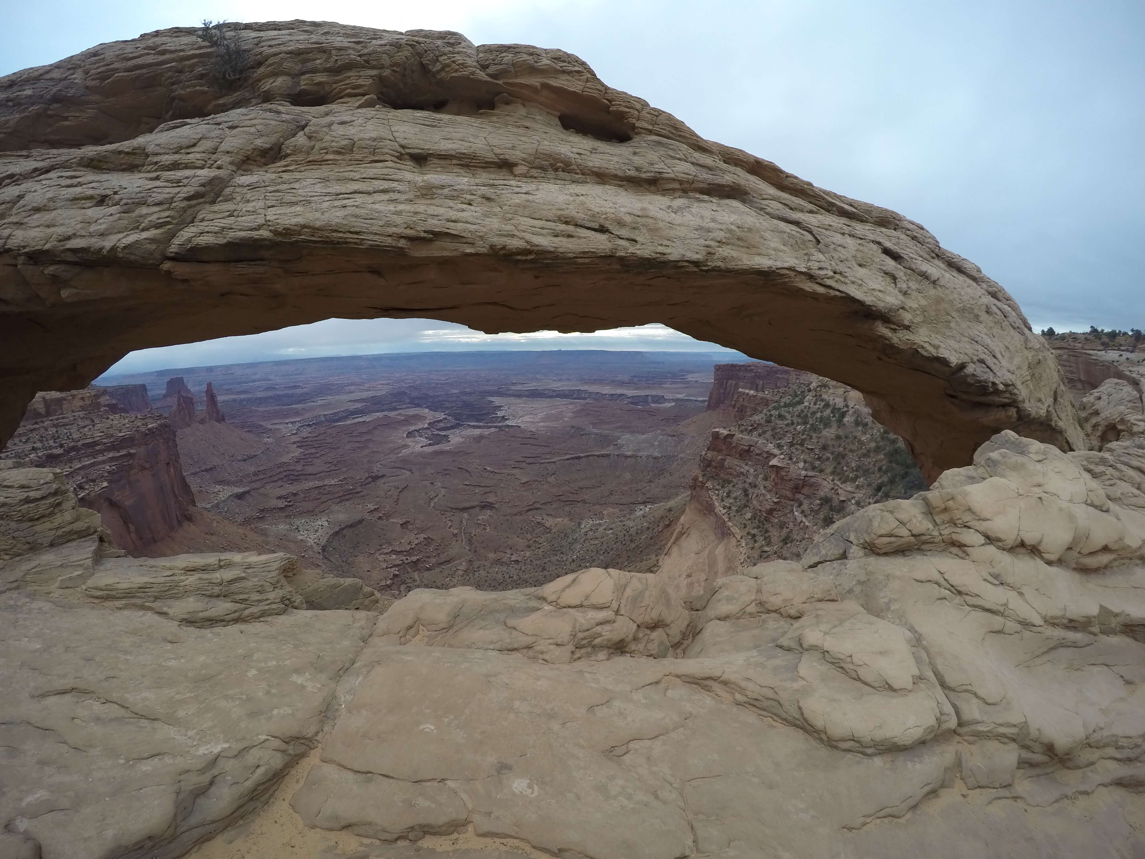
The day started off the day with an early drive out from Moab which took about an hour. We arrived at the park and went straight to the Mesa Arch trailhead. Yes, this park does have some arches but Arches National Park is still the location with the highest concentration of naturally forming arches in the world. Mesa is a quick less than a mile round trip hike with a spectacular arch at the end of the trail. The view through the arch is incredible. We saw a large number of photographers heading back to the trailhead when we were headed out. This must be a top spot for photographers to catch the sunrise with the beautiful arch in the picture.
 Mesa Arch Canyonland National Park
A short drive continuing on to the end of the road in Canyonlands brings you to Grand View Overlook Point trailhead. This is a fairly easy 2-mile round trip hike with somewhat primitive trails but all flat with little to no rock scrambling. The trail takes you along the edges of the canyon with some spectacular and scary views over the edge. Don't get too close!
 Edges of Island in the Sky trail to Grand View Point
The trail continues along the edges. One of the things that stood out to me the most was the fact that the trail does not have a posted end. But you sure will know when you are at the end because there is not another footstep further that you could take without taking what looks like a 500-foot vertical drop. It's not like you'll actually be able to do any more hiking without turning around. This is a popular trail, visited by many. We got a good spot on the edge of the trail where we could eat our snacks and be at the very edge of the Island in the Sky. We were lucky enough that on the way back a 10:30 AM ranger talk was just starting. The ranger gave details on how Canyonland formed as well as Arches. The biggest thing to understand from the whole talk was that this has taken hundreds of thousands of years to form and is ever-changing. What you see today will not be the same as what you will see a day from now, a week from now, a month from now, and especially thousands of years from now.
 The unmarked end of Grand View Point trail
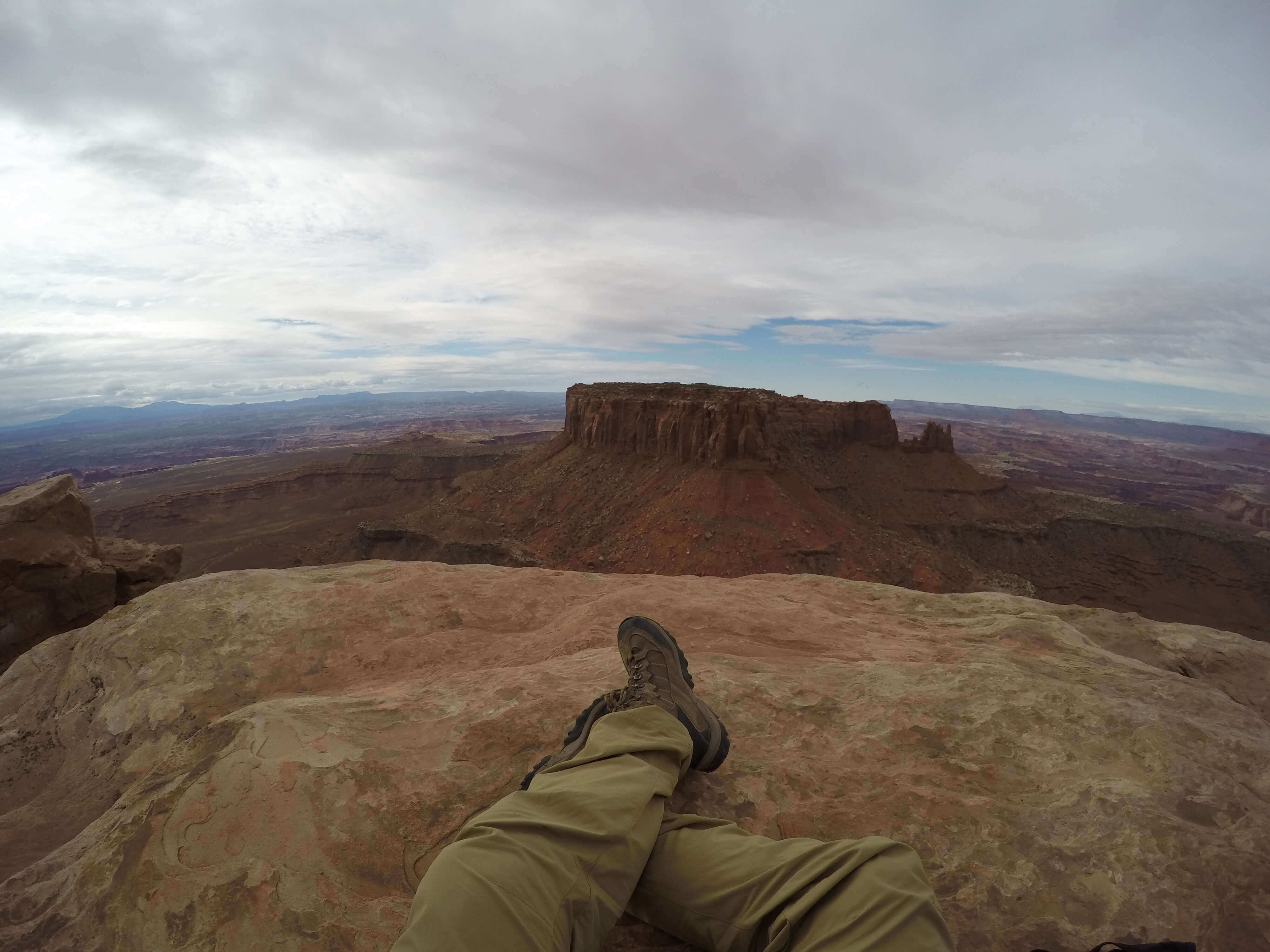
Our Canyonland visit did not stop there; we made one more visit to Whale Rock trailhead. A super quick 1-mile round trip trail to the top of a large rock called Whale Rock with breathtaking 360 views of Canyon Lands National Park. The hike is almost entirely primitive with a good bit of rock scrambling at the end. But since it is only a half-mile to the top of the rock it's a quick and easy way to get to an amazing vantage point.
 The start of the trail up to Whale Rock in Canyonland National Park
I cannot emphasize how beautifully blue the skies were that day and how incredibly far we could see in any direction from the top of Whale Rock. It seemed surreal to be able to stand on top of the rock and see for miles in all directions. It took all the worries away and left me feeling small on top of a huge rock sitting on top of a huge world. This would have to be my favorite view seen during the whole trip.
 On top of Whale Rock in Canyonlands National Park
Canyonlands is a park where you cannot get a full experience in just a day but you can explore many features of the park. It is much less visited compared to Arches but something well worth the day side trip. I hope to in the future explore more of Canyonlands; maybe doing a backpacking trip into the secluded wilderness of the park. I can compare the park to a miniature Grand Canyon but really it is more than that with a lot to offer to even someone who only has a day to spend there. This is a lesser-known national park you need to put on your list to visit.
We headed back to Moab but since we still had a lot of daylight left we needed to come up with something to do. We decided to spend the afternoon exploring the canyons of Moab on a Razor 4 seater ATV would be the perfect way to get deep into the canyons, and I mean deep, ~20 miles into the canyons. As a rider of dirt bikes for years, I can say the Razor was fast fun and handled the bumpy, rocky, sandy terrain way too well. It really was built and made for this sort of desert terrain. We followed Chicken Corners Safari Rte turning into Hurrah Pass and continued on through some of the rockiest and bumpiest trails I have ever been offroading on. The views on top of the many mesas were gorgeous. We passed a lot of camping spots along the way of Chicken Corners Safari Rte which piqued my interest for possible spots to stay in for the future.
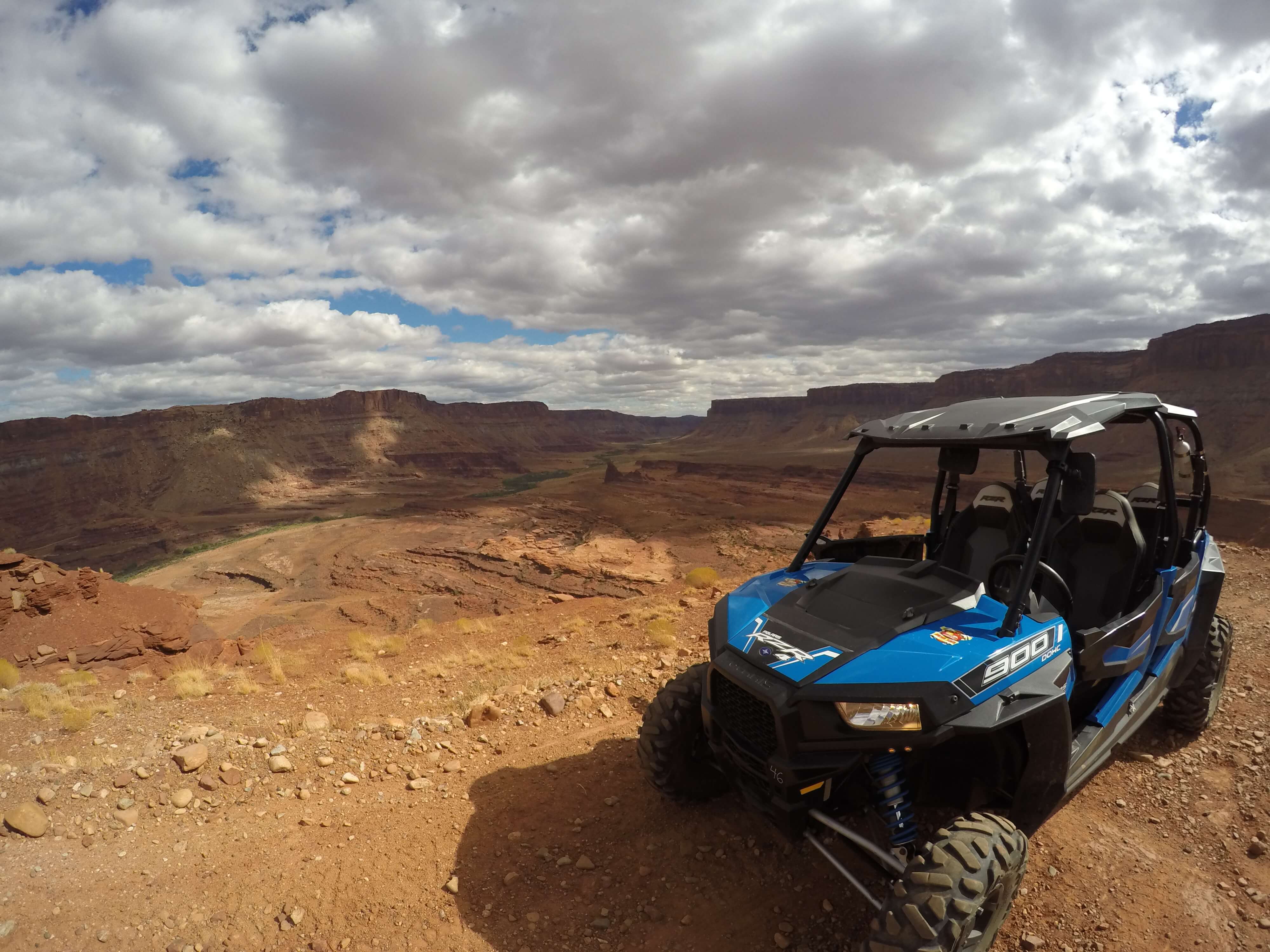 View along the Hurrah Pass Moab with our rented Razor 900cc ATV
**Sunday ** we spent our time back in Arches National Park. We knew we needed to see the iconic Delicate Arch from close up so we started our morning pulling up to the Delicate Arch trailhead. The 3-mile round trip really is not too difficult. It is marked as primitive because of the nonstandard trail but can easily be done by a novice hiker. There is no rock scrambling involved but this is not a graded trail so it is marked as primitive. The hardest part is the climb up a massive rock but the elevation gradient of the rock is not too high and if adequate time is taken it is not too difficult to tackle. Even though the hike is only 3 miles round trip, expect it to take a 3 hours total if you are not used to the elevation and not used to climbing uphill. We started early in the morning and got to Delicate Arch within 45 minutes but we took a few breaks and kept pushing through the uphill parts. The pace we kept may not be ideal for all.
The trail is primitive but compared to Double O arch it is easy to follow especially since it is so popular. We made it to Delicate Arch at about 9 AM and there were not too many people there already but by 9:30 and 10 more and more people were showing up. Lots of people were taking pictures and getting underneath the arch for the perfect candid picture. I got lots of great pictures in this morning time frame, but signs and people told us that afternoon is the busiest and best time for pictures. I can definitely see this as true since the sun will be in a much nicer position for solid pictures and less shadowing to dampen the photos but it was almost nicer to arrive at the arch without a huge crowd of people being there.
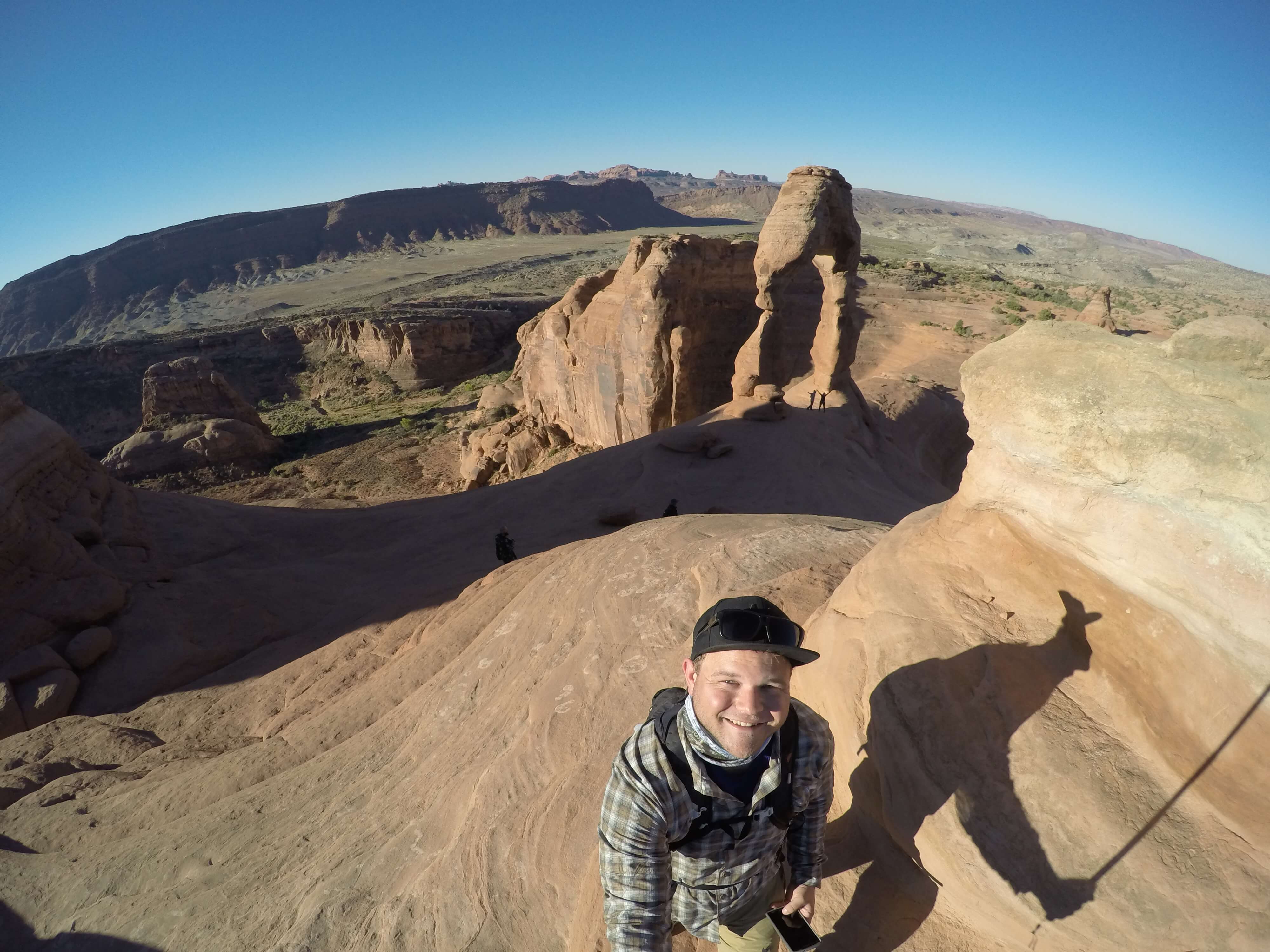 View of Delicate Arch, Arches National Park
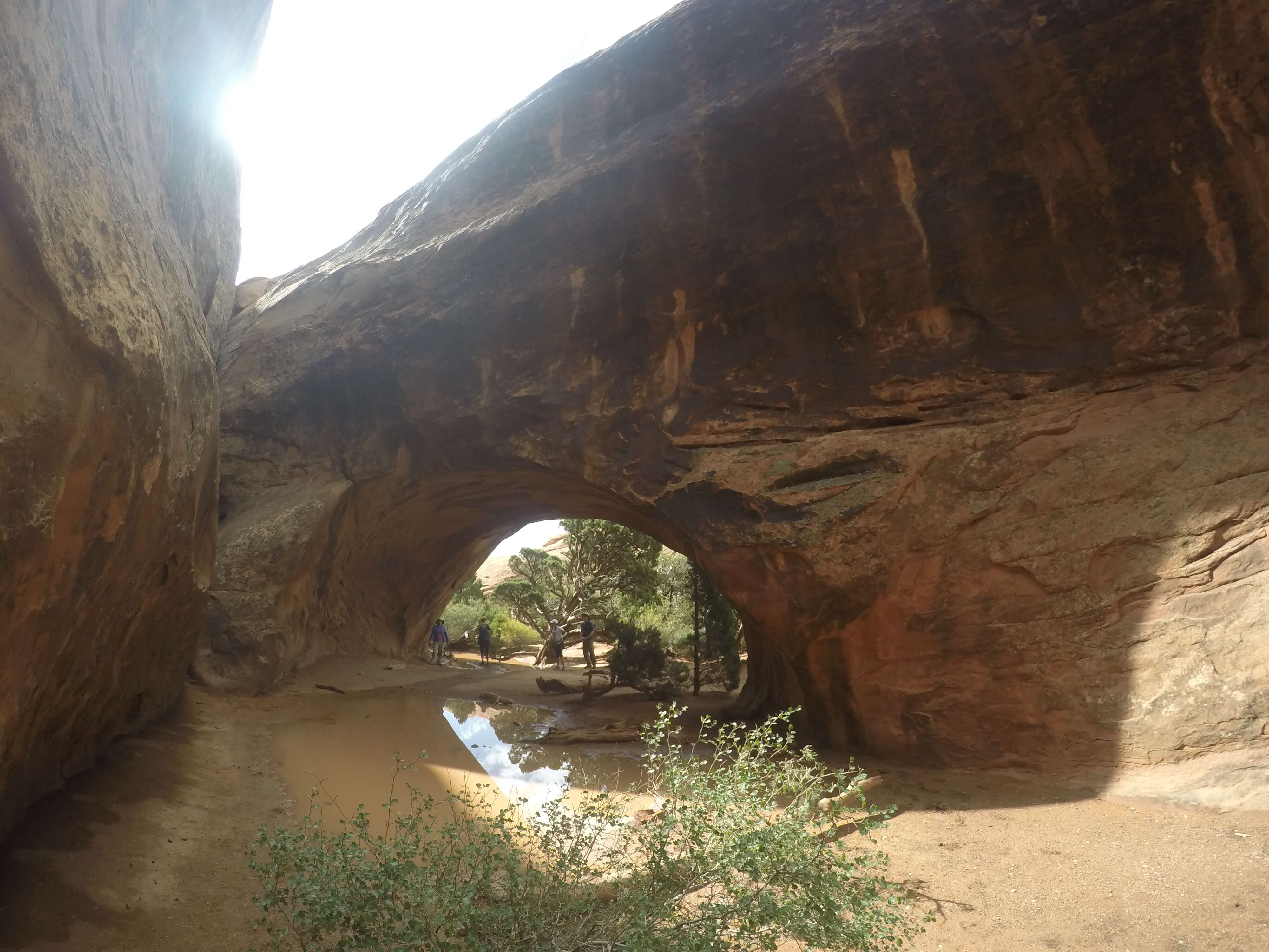
The second half of Sunday was spent on a ranger-led hike through the Fiery Furnace. I highly recommend doing this hike. You have to sign up for the hike at the visitor center but only 25 people can sign up per time slot. We signed up Thursday when we arrived and the first available time was not until Sunday! So sign-ups are a couple of days out but if the next available hike fits with your time frame sign-up! The hike is $16 dollars per person which is much cheaper than what the outfitters in Moab will charge you. The rangers will attempt to scare you a bit before signing up because the trails through the Fiery Furnace are very primitive so rock scrambling, jumping, and good balance will be needed. These trails can be considered harder than the one to Double O or Delicate Arch but still very doable by the average hiker. It really is not as hard as they play it out to be. Permits are needed to hike in this location on your own so I would highly recommend going with the ranger because of the nature of the hike. It would be very easy to get lost in the walls and caverns of the Fiery Furnace if you are not with a guide that knows where they are going.
 Heading into the Fiery Furnace, Arches National Park
The hike starts at the Fiery Furnace trailhead and makes a small elevation drop to get to the base of the Fiery Furnace. The reason for the name is not actually that the area where the hike is super warm but rather the spires look like fire when the sun hits at the right angle (generally sunrise). Inside the Fiery Furnace, it is actually very shaded and protected from the heat. The hike takes you through sections with 100 foot high walls either side that out of nowhere open up to grand views. The landscape around you changes quickly and often within the Fiery Furnace.
Make sure to watch out for areas with pooled water or areas that look like water could pool. These pools are known as Ephemeral Pools and can contain a plethora of life. Even when the pools are dried out, eggs of certain animals may be resting in the dried out hole waiting for a rainstorm to fill up the pool and have their life begin.
The Fiery Furnace ranger-led hike takes frequent breaks so it may not go at the pace that you would normally go. But this is necessary since there will be 25 people total on the hike of varying skill levels. It takes you through more secluded areas of the park visited only by few others. The hike gives you a different perspective of the park that you cannot get from the other trails. I highly recommend this hike! This was the last and one of the most fun hikes of our trip. It was a great way to end a grand trip to Arches National Park and Canyonlands National Park.
Monday consisted of heading back to Salt Lake City and getting on a plane to San Diego the even bigger city. Another early day and unfortunately it was our last. No hiking or national parks today just the drive back to Salt Lake City airport and a plane ride back home. The trip was a great success. I now have another checkmark I can put on my bucket list.